Online Mapping
Web App Extension
The Online Mapping is an extension/feature of the Network Data Collector Web App.
Description
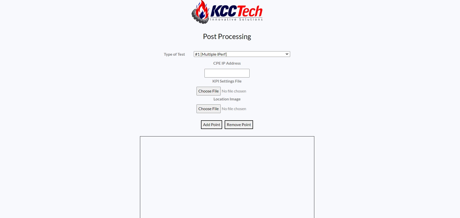
The goal for this feature of the Network Data Collector Web App was to create an indoor mapping feature, where the user can have the live KPI, throughput, or ping information displayed through colored points on a map. This feature uses Puppeteer to open a browser in the background and the 'spawn' function in the Child Process library to obtain the data for the mapping. Online Mapping has four inputs: typeOfTest, CPE Ip, KPI Settings file, and Location Image file. The typeOfTest is an input for the iPerf/Ping tests that will be run, which the commands are parsed from the config.csv file. The CPE Ip is an input in case the Ip address for the CPE's GUI webpage changes. The KPI Settings file contains the information for creating a legend and specifying which points are colored. Lastly, the Location Image is a picture file to simulate the live points being placed on the map. Intially, the user will select points on the map on the first page to show the start/stop points of each collection. Then, one-by-one the user will hit the start/stop to execute the program, eventually creating a map displaying all the information collected as points on the map. Additionally, the information collected from the CPE's GUI page and the iPerf/Ping tests are stored as log files in the test_logs folder created previously.
This tool provides an on-the-go testing ability for indoor or outdoor mapping at any location. With the addition of the map feature, the user can view the data live in the same area they are in.
Languages
Frontend: HTML, CSS, Javascript
Backend: Node.js, Express