Offline Mapping
Web App Extension
The Offline Mapping is an extension/feature of the Network Data Collector Web App.
Description
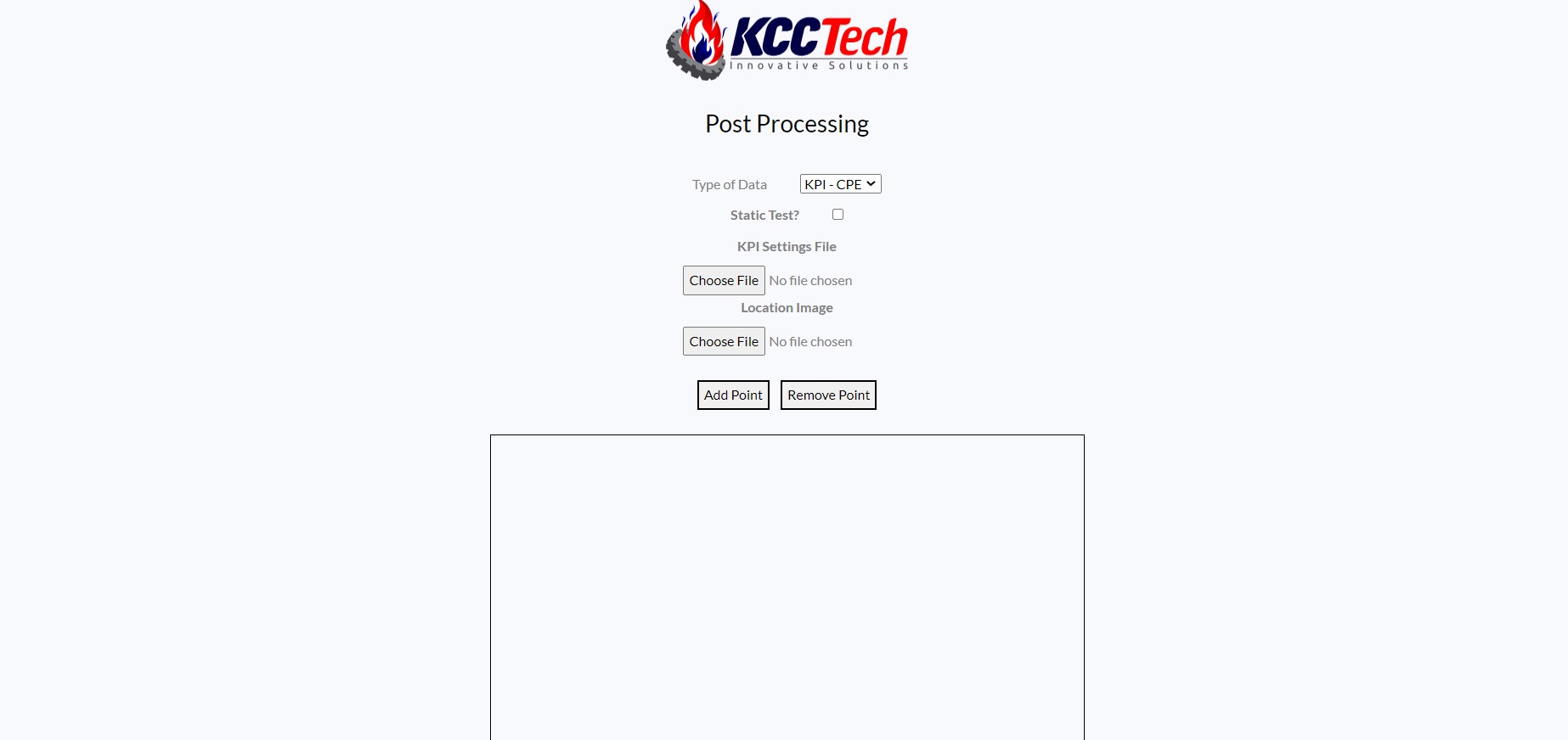
The goal for this feature of the Network Data Collector Web App was to create an indoor mapping feature, where the user can have post process KPI, throughput, or ping information collected previously and have it displayed through colored points on a map. This feature use the File Stream library to move through the post-processing and collection folders, as well as read and parse the information from the data files. Offline Mapping has four inputs: typeOfData, isStatic, KPI Settings file, and Location Image file. The typeOfData is a drop-down input, in which the user will select the type of data that will be used and displayed on the map. This selection will determine which folder will be used to read data. The isStatic input is a button that, if pushed, will display the data as if the user was standing still, simulating a static test. The KPI Settings file contains the information for creating a legend and specifying which points are colored. Lastly, the Location Image is a picture file to simulate the live points being placed on the map. Intially, the user will select points on the map on the first page to show the start/stop points of each collection. Then, the points will be displayed on the map in either a circle at each point if the user selected a static test, or will make a line of points if the test is dynamic. The dots will only be drawn if they fit the criteria specified in the legend. The Offline Mapping feature can also use the information collected from the Single Data Collection feature and display the information as well.
This tool provides an on-the-go testing ability for indoor or outdoor mapping at any location. With the addition of the map feature, the user can view the data that was collected previously and have an additional check to ensure the information they read was correct.
Languages
Frontend: HTML, CSS, Javascript
Backend: Node.js, Express